PanAfGeo Logo
Calendar Icon
EU Emblem

Geoscientific Information Management – Completion of training WP7-B, Yaoundé, Cameroun – 9-20 April 2018

GESTION DE L’INFORMATION GÉOSCIENTIFIQUE
Infrastructure de données géoréférencées – Modélisation de données Normes d’interopérabilité – Diffusion de données
YAOUNDE, CAMEROUN – 9-20 AVRIL 2018

Yaoundé, 21 avril 2018
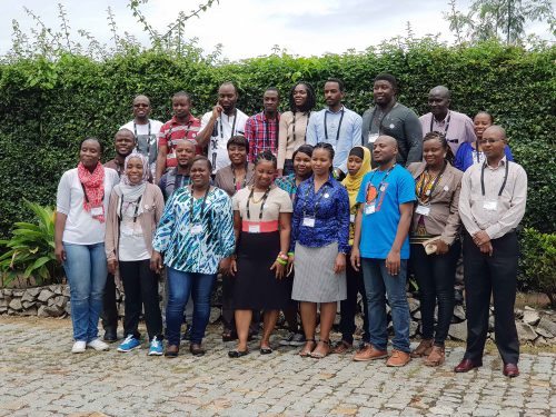
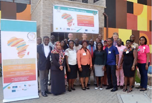
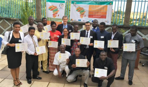
« Infrastructure de données géoréférencées – Modélisation de données – Normes d’interopérabilité – Diffusion de données » : une session de formation de 10 jours du programme PanAfGeo sur la « Gestion de l’Information géoscientifique » s’est tenue à Yaoundé, Cameroun, du 9 au 20 avril 2018.

16 professionnels du traitement de données géoscientifiques de 10 pays (Burkina Faso, Cameroun, Gabon, Guinée-Bissau, Madagascar, Maroc, Niger, Sénégal, Togo et Union des Comores) ont participé à cet atelier de formation. Il était organisé conjointement par le Service géologique français (BRGM) et la Direction de la Géologie du Ministère des Mines, de l’Industrie et du Développement technologique (MINMIDT) du Cameroun. Une centaine de candidatures a été reçue de la part des services géologiques et directions des mines et de la géologie à travers l’Afrique. Les candidats sélectionnés pour cette session représentaient plusieurs types d’organisations géoscientifiques et avaient un parcours technique de géologues, géomaticiens, etc.

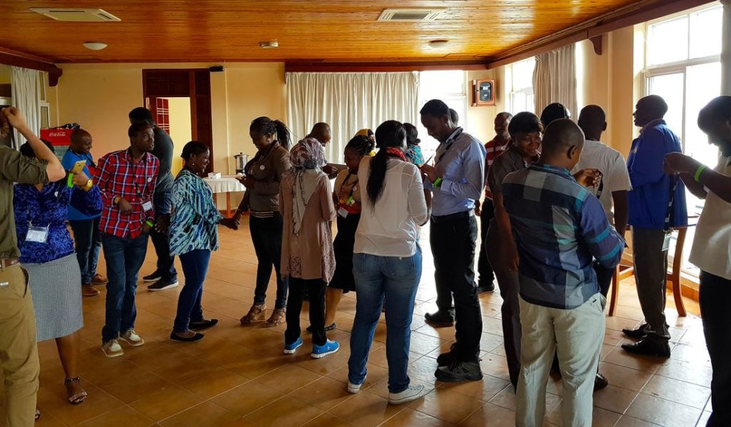
Cet atelier de formation était centré sur le renforcement dans la gestion de données géoréférencées. Ceci en présentant différentes méthodes et différents outils dans la modélisation, le stockage, le traitement et la diffusion de données.

Malgré quelques problèmes logistiques qui ont retardés la livraison des ordinateurs portables, la formation a pu aboutir à des ateliers pratiques mettant en oeuvre les différentes théories, normes et outils abordés lors de la première semaine de formation. Les participants ont notamment pu développer des compétences dans l’utilisation d’outils open source tels que GeoKettle, PostgreSQL/PostGIS, GeoServer.

En fin de deuxième semaine, chaque stagiaire a préparé puis présenté son Plan de Retour au poste de Travail, c’est-à-dire sa contribution au processus de renforcement des capacités du WP7. Il s’agit là d’un indicateur de la réussite de la mise en oeuvre du programme des formations PanAfGeo. Il était demandé de concevoir une application à court terme de leurs nouvelles connaissances et compétences dans l’intérêt de leur organisation de rattachement et à mettre en place dans les 3 à 6 mois après l’atelier.

Les Plans de Retour au poste de Travail présentés couvraient un éventail significatif d’objectifs tels que :
• Organiser des formations internes pour partager les connaissances nouvellement acquises à leurs collègues ;
• Inventorier et cataloguer les données et informations disponibles au sein de leurs organisations ;
• Organiser la collecte de données complémentaires pour actualiser les bases de données existantes ;
• Modéliser et créer des bases de données afin de capitaliser au sein d’une Infrastructure de données géoréférencées ;
• Diffuser les données existantes et/ou nouvelles via un géoportail à créer ou à faire évoluer.

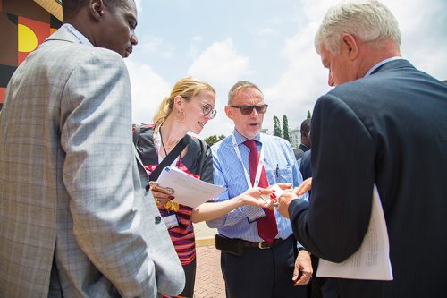
Le contenu de l’atelier et les supports de formation ont été organisés par Francois TERTRE et Jean GONÇALVES du Service géologique français (BRGM). Les contributions de Marc URVOIS, Responsable du module WP7 de PanAfGeo, avec l’appui d’Abdoulaye OUEDRAOGO, Co-Responsable du WP7, Bureau des Mines et de la Géologie du Burkina (BUMIGEB), ont été essentielles pour la réussite de cet atelier.

Des remerciements particuliers sont adressés à Mme Florence TCHOFFO, Chef de Service, Suivi des Projets de Recherche Minière à la Direction de la Géologie (MINMIDT) qui a facilité la coordination des moyens locaux pour que l’atelier se déroule dans les meilleures conditions possibles.

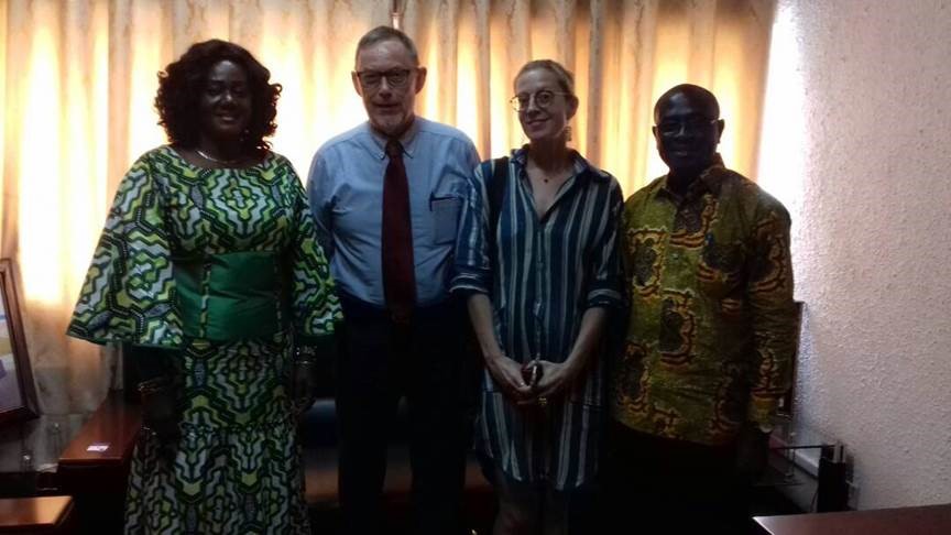
Les cérémonies d’ouverture et de clôture de l’atelier ont été placées sous le haut patronage du Ministère des Mines, de l’Industrie et du Développement technologique représenté par le Pr. A. MOUNDIR, Secrétaire Général, Mr NGORAN Genesis BIME, Inspecteur Principal, Cabinet du Ministre et Mme J.-P. DONGMO, Directrice, Direction de la Géologie. La Délégation de l’Union européenne au Cameroun était représentée par Mr Benedikt MADL, Premier Secrétaire, Section Coopération et Mr Mats LILJEFELT, Premier Conseiller, Chef des Opérations de Coopération. L’ambassade de France au Cameroun était représentée par Mr Nicolas FRELOT, Conseiller de Coopération et d’Action Culturelle.

Prochaines sessions de formation :
Les objectifs à long terme du Workpackage 7 (WP7) de PanAfGeo « Gestion de l’Information géoscientifique » sont :
(1) La gestion de la connaissance géologique et la diffusion de l’information publique à travers des noeuds nationaux au sein d’un réseau panafricain ainsi qu’un système d’informations géologiques et minières en appui aux activités développées par un large éventail de de parties prenantes nationales et régionales ;
(2) Améliorer et/ou renforcer les compétences du personnel employé par les services géologiques et/ou les directions des mines africaines dans le domaine de la gestion des données géoscientifiques et des technologies de l’information :
o Gestion de bases de données, traitement de données géoréférencées et interface SIG (WP7-A),
o Infrastructure de données géoréférencées – Modélisation de données – Normes d’interopérabilité – Diffusion de données (WP7-B),
o Modélisation géologique 3D multicouche avec logiciel géoscientifique (WP7-C).

La prochaine session de formation (WP7-A) se déroulera à l’automne 2018 dans un pays francophone d’Afrique de l’Ouest.

Day 1: Environmental management of mines training in Mwanza, Tanzania

This Tuesday was the first day of the course “Environmental management of mines” in Mwanza, Tanzania. 24 participants from 10 countries in Africa will have two weeks of training composed of field visits, lectures and exercises. SGU is leading the training within the project PanAfGeo, which is a collaboration between the European geological surveys and the African geological surveys to increase the knowledge about mining. The project is co-funded by the European Union and IGF (Intergovernmental Forum on Mining, Minerals, Metals and Sustainable Development). For this training SGU is also collaborating with AMGC, which is hosting the training in Tanzania. The pictures show a group photo of the participants as well as a photo from a teambuilding exercise the first day.


Geoscientific Information Management – Completion of training WP7-C, Dakar, Sénégal – 15-26 Janvier 2018

GESTION DE L’INFORMATION GÉOSCIENTIFIQUE
Modélisation géologique 3D multicouche avec logiciel géoscientifique
DAKAR, SENEGAL – 15-26 JANVIER 2018

Dakar, 27 janvier 2018
« Modélisation géologique 3D multicouche avec logiciel géoscientifique » : une session de formation de 10 jours du programme PanAfGeo sur la « Gestion de l’Information géoscientifique » s’est tenue à Dakar, Sénégal, du 15 au 26 janvier 2018.

15 professionnels du traitement de données géoscientifiques de 8 pays (Burkina Faso, Djibouti, Gabon, Guinée, Guinée-Bissau, Niger, Sénégal et Union des Comores) ont participé à cet atelier de formation. Il était organisé conjointement par le Service géologique français (BRGM) et la Direction de la Prospection et de la Promotion Minière (DPPM) du Ministère des Mines et de la Géologie du Sénégal. Plus de 50 candidatures ont été reçues de la part des services géologiques et directions des mines et de la géologie à travers l’Afrique ainsi que de l’Université Cheik Anta Diop de Dakar. Les candidats sélectionnés pour cette session représentaient plusieurs types d’organisations géoscientifiques et avaient un parcours technique de géologues, géomaticiens, etc.

Cet atelier de formation était consacré à la modélisation géologique en général, avec un focus particulier sur les applications en contexte multicouche (bassin sédimentaire, veines minéralisées). Les thématiques abordées ont concerné : (1) la préparation et la mise en forme des données (sondage, carte géologique, topographie, ..) en vue de construire un modèle géologique 3D, (2) les techniques de vérification et de visualisation de ces données, (3) les étapes de construction du modèle géologique et les moyens de le visualiser/diffuser notamment en lien avec les outils SIG, (4) les calculs de tonnage, volumes et teneurs.

La formation s’est déroulée sous forme d’alternance entre exposés théoriques (<25%) et mise en pratique sur ordinateur (>75%). Le logiciel (GDM-MutiLayer, développé par le BRGM) ainsi qu’un ordinateur portable, des jeux de données et les supports de formation ont été fournis aux participants pour appliquer concrètement les concepts théoriques. Une journée complète de travail en autonomie avec encadrement par les formateurs a permis aux participants de s’approprier ces techniques et l’utilisation du logiciel GDM, de façon à mettre en pratique par eux-mêmes l’ensemble des concepts abordés pendant ces deux semaines puis de retour dans leurs organisations respectives.

En fin de deuxième semaine, chaque stagiaire a préparé puis présenté son Plan de Retour au poste de Travail, c’est-à-dire sa contribution au processus de renforcement des capacités du WP7. Il s’agit là d’un indicateur de la réussite de la mise en oeuvre du programme des formations PanAfGeo. Il était demandé de concevoir une application à court terme de leurs nouvelles connaissances et compétences dans l’intérêt de leur organisation de rattachement et à mettre en place dans les 3 à 6 mois après l’atelier.

Les Plans de Retour au poste de Travail présentés couvraient un éventail significatif d’objectifs tels que :
• Création du modèle géologique 3D d’un bassin sédimentaire pour les ressources en matériaux ;
• Mise en cohérence de jeux de données et production de logs harmonisés ;
• Contrôle des données et résultats présentés par les compagnies minières ;
• Mise en place un service de gestion des données géoscientifiques.

Le contenu de l’atelier et les supports de formation ont été organisés par Bernard Bourgine et Christelle Loiselet du Service géologique français (BRGM). Ils ont été assistés dans l’animation par Abdoul Aziz Ndiaye et Mahamadane Diène de l’Institut des Sciences de la Terre de l’Université Cheik Anta Diop de Dakar. Les contributions de Marc Urvois, Responsable du module WP7 de PanAfGeo, avec l’appui d’Abdoulaye Ouedraogo, Co-Responsable du WP7, Bureau des Mines et de la Géologie du Burkina (BUMIGEB), ont été essentielles pour la réussite de cet atelier.

Des remerciements particuliers sont adressés à Mme Rokhaya Samba, Directrice, DPPM, qui a facilité avec son équipe la coordination des moyens locaux pour que l’atelier se déroule dans les meilleures conditions possibles.

Les cérémonies d’ouverture et de clôture de l’atelier ont été placées sous le haut patronage de Mme Aïssatou Sophie Gladima, Ministre des Mines et de la Géologie, ainsi que Mme Cécile Tassin-Pelzer, Chef de la Coopération à la Délégation de l’Union européenne au Sénégal et Mr Pierre-Yves Bertrand, Conseiller régional développement durable à l’Ambassade de France au Sénégal.

Prochaines sessions de formation :
Les objectifs à long terme du Workpackage 7 (WP7) de PanAfGeo « Gestion de l’Information géoscientifique » sont :
(1) La gestion de la connaissance géologique et la diffusion de l’information publique à travers des noeuds nationaux au sein d’un réseau panafricain ainsi qu’un système d’informations géologiques et minières en appui aux activités développées par un large éventail de de parties prenantes nationales et régionales ;
(2) Améliorer et/ou renforcer les compétences du personnel employé par les services géologiques et/ou les directions des mines africaines dans le domaine de la gestion des données géoscientifiques et des technologies de l’information :
o Gestion de bases de données, traitement de données géoréférencées et interface SIG (WP7-A),
o Infrastructure de données géoréférencées – Modélisation de données – Normes d’interopérabilité – Diffusion de données (WP7-B),
o Modélisation géologique 3D multicouche avec logiciel géoscientifique (WP7-C).

La prochaine session de formation (WP7-A) se déroulera à Yaoundé, Cameroun (9-20 avril 2018).

Strengthening the skills of African geological services

An opening of a technical and scientific workshop on 3D geological modeling in Dakar

The pan-African geoscience (PanAfGeo) training project for geological services personnel from Africa is scheduled between January 15 to January 26, 2018, in Dakar. The training workshop is focused on geological modelling in multilayered 3D with geo-scientific software and it received few crucial media coverage:

– Le Petit Journal

– Lactuacho


Geoscientific Information Management – Completion of training WP7-A, Accra, Ghana – 20 Nov-1 Dec 2017

GEOSCIENCE INFORMATION MANAGEMENT
Database management, handling of spatial data and GIS interface
ACCRA, GHANA – 20TH NOVEMBER-1ST DECEMBER 2017

Accra, 2nd December 2017

“Database management, handling of spatial data and GIS interface”: a 10-day training session of the PanAfGeo programme on Geoscientific Information Management was held in Accra, Ghana, 20 November-1 December 2017.

17 geodata professionals from 11 African countries (Ethiopia, Ghana, Kenya, Liberia Namibia, Niger, Nigeria, Sierra Leone, Sudan, Tanzania and Zimbabwe) took part in this training. It was jointly organised by the Geological Survey of Denmark and Greenland (GEUS) and the Ghana Geological Survey Authority (GGSA). More than 150 applications have been received from Geological Survey Organisations throughout Africa. The applicants selected for this training represented different organisational units in these surveys and they had a varied background such as geologists, information technology specialists, cartographers, etc.

This training was organised as classroom type sessions including hands-on exercises using sample data sets with different open source software. The main theme of the training was on spatial products, data management and integration. The participants presented their organisation and the spatial data management in their country.

PanAfGeo module WP7-A training focused on strengthening geosciences information management capabilities by presenting different methods, approaches, tools, procedures and requirements for creating spatial products, and doing data management.

The interactive mode of learning through a systematic lecturing approach and practical exercises on computers facilitated a quick learning process in gaining new skills to use open source software such as Quantum GIS, GeoKettle, PostgreSQL/PostGIS and GeoServer.
Over the second week, each trainee had to prepare and present a Return-to-Work Plan as his/her active contribution to the WP7 capacity building process. This is an indicator of the successful implementation of the PanAfGeo training sessions. They were requested to design a short-term application of their newly acquired knowledge through a project of interest for their Geological Survey Organisation and to be possibly implemented over a period of 3 to 6 months after the training.

These Return-to-Work Plans proposed a significant panel of objectives such as:
• Improving and reinforcing the skills of their colleagues in organising trainings;
• Designing a central database gathering all available data;
• Promoting the geoscience data online and populating existing web map portals.

The training curricula and material was organised by Mr. Frands Schjøth and Mr. Bjarni Pjetursson from the Geological Survey of Denmark and Greenland (GEUS). The successful completion of the training session was made possible by the dedicated work of Ms. Keren-Happuch Osekre, Yvonne Marfoa Anokwa and Mr. Emmanuel Adu-Gyamfi from the Ghana Geological Survey Authority (GGSA). The contributions from the WP7 Leader, Mr. Marc Urvois from French Geological survey (BRGM) with support of WP7 co-Leader Mr. Abdoulaye OUEDRAOGO from the Bureau of Mines and Geology of Burkina Faso (BUMIGEB) were also instrumental in this success.
Special thanks are also intended to Mr. Daniel Boamah, Director, GGSA, who facilitated the local coordination to make this training possible in the best conditions.

Coming training sessions:
PanAfGeo Work Package 7 (WP7) “Geoscience Information Management” long-term objectives are:
(1) Geological knowledge management and dissemination of public information through national nodes within a pan-African network along with a geological and mineral information system to support activities developed by a wide panel of national and regional stakeholders;
(2) To improve and/or strengthen the skills and capabilities among the staff employed by the African Geological Survey Organisations in the field of geoscience information management and related information technologies:
o Database management, handling of spatial data and GIS interface (WP7-A)
o Spatial data infrastructure-Data modelling-Interoperability standards-Data dissemination (WP7-B)
o Multilayer 3D geological modelling using dedicated geoscience software (WP7-C)
The next training session (WP7-C) will take place in Dakar, Senegal (15-26 January 2018).

Geoscientific Information Management – Completion of training WP7-B, Dar Es Salaam, Tanzania – 16-27 October 2017

GEOSCIENCE INFORMATION MANAGEMENT
Spatial Data Infrastructure – Data Modelling Interoperability Standards – Data Dissemination
DAR ES SALAAM, TANZANIA – 16-27 OCTOBER 2017

Dar es Salaam, 27 October 2017

“Spatial Data Infrastructure – Data modelling – Interoperability standards – Data dissemination”: a 10-day training session of the PanAfGeo programme was held in Dar es Salaam, Tanzania, 16-27 October 2017.

17 geodata professionals from 13 African countries (Botswana, Burkina Faso, Ethiopia, Ghana, Guinea-Bissau, Kenya, Malawi, Namibia, Niger, Nigeria, Sierra Leone, Tanzania and Uganda) took part in this training. It was jointly organised by the Geological Survey of Slovenia (Slovenia) and the African Minerals & Geosciences Centre (Tanzania). More than 150 applications have been received from Geological Survey Organisations throughout Africa. The applicants selected for this training represented different organisational units in these surveys and they had a varied background such as geologists, information technology specialists, cartographers, etc.

This training was organised as classroom type sessions including hands-on exercises using sample data sets with different open source software. The main theme of the training was on Spatial Data Infrastructure (SDI) i.e. how to make geological data interoperable and available to a wide range of stakeholders and end users. The participants presented their organisation and the level of existing SDI in the field of geology in their country.

PanAfGeo module WP7-B training focused on strengthening geosciences information management capabilities by presenting different methods, approaches, tools, procedures and requirements for interoperability standards, data modelling, data management and data publishing.

The interactive mode of learning through a systematic lecturing approach and practical exercises on computers facilitated a quick learning process in gaining new skills to use open source software such as GeoKettle, PostgreSQL, PostGIS, Geoserver and GeoNetwork.
Over the second week, each trainee had to prepare and present a Return-to-Work Plan as his/her active contribution to the WP7 capacity building process. This is an indicator of the successful implementation of the PanAfGeo training sessions. The trainees were requested to design a short-term application of their newly acquired knowledge through a project of interest for their Geological Survey Organisation and to be possibly implemented over a period of 3 to 6 months after the training.

These Return-to-Work Plans proposed a significant panel of objectives:
• Improving and reinforcing the skills of their colleagues in organising trainings on SDI;
• Designing a central database gathering all available data presently disseminated in the Geological Survey;
• Organising the scanning of vast data information already existing at their organisations;
• Building a metadata catalogue and setting up a web-enabled catalogue portal;
• Promoting the geoscience data online and populating existing web map portals.

The training curricula and material was organised by Ms. Špela Kumelj and Mr. Matija Krivic from Geological Survey of Slovenia (GeoZS, Slovenia). The successful completion of the training session was made possible by the dedicated work of Mr. Mesfin Wubeshet Gebremichael and Mr. Kamina Chororoka from the African Minerals & Geoscientific Centre in Tanzania (AMGC). The contributions from the WP7 Leader, Mr. Marc Urvois from French Geological survey (BRGM) with support of WP7 co-Leader Mr. Abdoulaye OUEDRAOGO from the Bureau of Mines and Geology of Burkina Faso (BUMIGEB) were also instrumental in this success.

Special thanks are also intended to Mr. Ibrahim Shaddad, General Director, AMGC, who made the AMGC facilities available to make this training possible in the best conditions.

Coming training sessions:
PanAfGeo Work Package 7 (WP7) “Geoscience Information Management” long-term objectives are:
(1) Geological knowledge management and dissemination of public information through national nodes within a pan-African network along with a geological and mineral information system to support activities developed by a wide panel of national and regional stakeholders;
(2) To improve and/or strengthen the skills and capabilities among the staff employed by the African Geological Survey Organisations in the field of geoscience information management and related information technologies:
o Database management, handling of spatial data and GIS interface (WP7-A)
o Spatial data infrastructure-Data modelling-Interoperability standards-Data dissemination (WP7-B)
o Multilayer 3D geological modelling using dedicated geoscience software (WP7-C)
The next training session (WP7-A) will take place in Accra, Ghana (20 Nov – 1 Dec. 2017).

Environmental Management of Mines training held in Dakar, Senegal.

“Environmental Management of Mines”, a 12 day training programme in the PanAfGeo project was held in Dakar, Senegal, 3-14 July, 2017.

21 professionals from Burkina-Faso, Central African Republic, Chad, Gabon, Guinea, Guinea-Bissau, Mali, Niger and Senegal took part in the training. The training was jointly organised by the Geological Survey of Sweden and the “Direction de la Prospection et de la Promotion Minière (Senegal). The training received more than 50 applications from staff at geological services in the region. The applicants selected for the training represented several different organisational units at the surveys and had a varied background comprising environmental specialists, mining engineers and geologists.

Lectures and training session were held by a team of professionals from Senegal, Mali, Denmark and Sweden. Dr. Seydou Keita (Mali), Prof. Serigne Faye, Dr. Samba Rokhaya, Director Rosaline Mbaye, Dr. Birane Niane (all Senegal), John Tychsen (Denmark) and Mattias Fackel (Sweden).

Lectures of geosciences and environmental management were throughout the training integrated in daily group exercises and analysises. The theme of the training was above all how the treated subjects are integrated at the workplaces and in the geological surveys. How is environmental management part of the day to day work of the participants? What are the possibilites and challenges? Which regulations, policies, organisations, collaborations and interactions are available or could be developed? All participants presented their organisations and a national review of environmental management of mines.

The participants rated and evaluated environmental risks, management practices and organisatinal challenges. The participants analysed and illustrated the legal framework, organisation of and interactions of environmental management of mines in their countries. Several examples from current mining projects were presented. In particular examples of rehabilitation, mine closure, public participation and stake holder interaction in mining projects were appreciated and discussed. Lectures, group exercises, field visits and discussions were at the end fused into an action plan for each participant to take home.

Some of the subjects were:

– the regional legal framework,
– mine rehabilitation and mine closure,
– environmental impact assessment,
– small scale mining and the environment,
– acid rock drainage and waste management,
– hydrogeology, water and mines,
– mercury and cyanide in gold mining,
– public participation, sustainability and post-mining projects.

Site visits took the participants to the Lam-Lam phosphate deposits and to Grand Côtes Operations’ heavy mineral sands project. Many thanks to the management and staff at Grand Côtes Operations SA, Sephos SA and African Investments Group for sharing their experiences in environmental management of mines and showing how it is implemented at their operations.

Significant international Media Coverage of the first Artisanal and Small-Scale Mining training

First training in Artisanal and Small-Scale Mining is over with a significant international media coverage:

– Ghanaian Times

– Daily Graphic

– Ghana News Agency: article 1/ article 2

-National radio: Citi radio:

– Africa Newsroom.com:

– IGF (Canada):

– Denmark in Ghana (Ministry of Foreign Affairs of Denmark):

– EuroGeoSurveys NEWS: 

Success of the first training on Artisanal and Small-Scale Mining

On Friday 22nd of September, WP3 team leader Dr John Tychsen and the project assistant Mrs Ulla Holm have been invited to report on the results from the workshop to:

  • Hon. Benito Owusu Bio deputy minister of land and Natural Resources.
  • Hon. Barbara Oteng-Gyasi deputy minister of Land and Natural Resources.

The two Hon. Deputy Minister were very happy with the result of the workshops and the assistance provided by PanAfGeo. Please find below some pictures from the meeting.

PanAfGeo first training on Artisanal and Small-Scale Mining

PanAfGeo Work Package 3 is delivering a training to African governments on managing artisanal and small-scale mining.

PanAfGeo plays an important role in increasing the geological knowledge of African countries and is focused on helping governments improve estimates of their national mineral reserves in order to have a clearer view of potential revenues and increase bargaining power with mining firms. It is a collaboration between IGF (Intergovernmental Forum on Mining, Minerals, Metals and Sustainable Development), the EuroGeoSurveys (EGS) and its counterpart in Africa, the Organisation of African Geological Surveys (OAGS).

The European Commission has also provided financial support for PanAfGeo’s WP3 program, which aims to deliver seven regional training sessions in 2017-2019.

The first training session takes currently place in Accra, Ghana September until the 21st, 2017.  More than 40 representatives from Ghana and 11 representatives from the geological surveys in neighbouring countries will be attending the training. The first training session takes currently place in Accra, Ghana until the 21st of September 2017.

The main aim of the workshop is to train staff from the Ghana Geological Survey Authority (GGSA), regulatory agencies and the universities involved in the Artisanal and Small-Scale Mining (ASM) sector to strengthen their capacity to assist ASM operators in Ghana while providing regional perspectives. Particular emphasis will be on how the knowledge and skills resources of the GGSA can be mobilized more actively in the service of ASM operators so as to ensure more profitable, efficient, environmentally friendly, safe and sustainable mining operations in Ghana.

ASM operations employ more than 1 million people in Ghana and provide a livelihood to approximately 4-6 million. It is estimated that legal ASM accounts for more than one third of gold exports from Ghana while the share provided by illegal ASM is unknown.

Thus, while legal ASM contributes significantly to Ghana’s GDP, illegal mining is a sustained and increasing cause of concern. In fact, what is referred to as “Galamsey,” is threatening to pollute and spoil vital water bodies and farmlands, thus putting the country’s economy and citizens’ livelihood and health at risk. Civil society organisations and top authorities in Ghana, including President Nana Akufo-Addo, have joined forces to fight “Galamsey.”

Yet, even legal miners rarely undertake sufficient pre-operation geological investigation and miners tend to shy away from authorities and governmental scrutiny, knowing they will be called out as “scape goats” or face repercussions in the event of unwanted mining footprints. Being a nonregulatory body, the GGSA could come to play a crucial role in helping legal ASM operators mine more efficiently and knowledgeably by way of knowledge transfer and on-site guidance. Because the mandate of GGSA is mainly geo-scientific research/advisory, GGSA staff stand a better chance of “nudging: miners to optimize their operations in accordance with state-of-the-art methods, thus helping to bring the mining sector onto a less damaging track.

The training seeks to lend geo-scientific support to and empower GGSA staff to become such crucial partners in improving mining operations in Ghana and to provide know-how to mining operators across Africa.
It was organized jointly with Ghana Geological Survey Authority (GGSA) with participants from national geological surveys in Sierra Leone, Gambia, Liberia, and Nigeria. The WP3 training session in Ghana is providing be provided by the Geological Survey of Denmark and Greenland (GEUS) and a number of local co-trainers from GGSA, MC and the universities. For more details, you may view the press release and training program.

Following the training session, a Handbook on ASM in Ghana will be developed by the trainers and co-trainers based upon this handbook outline. The handbook is intended as a reference book for the ASM sector in Ghana produced by national experts in the ASM sector. A soft copy of the handbook, the video of the presentations and the provided power point presentations will be available on the PanAfGeo website. It is the hope of PanAfGeo that this material will serve as a manual used in additional training sessions in Ghana on issues related to ASM.

Several media are already covering the success of the training, like Daily’s Graphic and the Ghana News Agency article (1) article (2) and on the Ghanaian Times.

The second training session is tentatively scheduled to be in Lusaka, Zambia March 13-16, 2018 and organized jointly with Geological Survey of Zambia and the UNDP ACP program in Zambia. This training session is expected to have regional participation from national geological surveys in Namibia, Zimbabwe, Botswana and South Africa.

For questions regarding WP3 please contact:

WP3 Leader John Tychsen (GEUS): Mail: JT@geus.dk
WP3 Co-leader Daniel Boamah (GGSA):  Mail: boamahkwaku@yahoo.com
WP3 Deputy Co-Leader Jules Cesar Yaganza : Mail: legrand_cesar@yahoo.fr

https://business-hall.khm.gov.ua/ https://cnap.khm.gov.ua/ https://shevchenko.khm.gov.ua/ https://veteran.khm.gov.ua/ https://zonbox.pl/