
The International project PanAfGeo targetted at the practical improvement and capacity building for the staff of geological surveys of African countries, members of the Organization of African Geological Surveys. The programme supported by the European Union is launched in cooperation between the consortium of 12 European geological surveys and the African geological surveys. The training has been conducted in various African countries for over three years, to anchor the crucial practical skills in the field geological mapping. This year it is launched in Tigray, Northern Ethiopia, from 4th February to 1st March, under the supervision and support by the Geological Survey of Ethiopia.
The final awarding of the participants´ certificates for trainees and the official closing ceremony is held at the Consolar Hotel in Axum on Friday 1 March, from 14.00 p.m.
The fifth round of training in “Field Geological Mapping” follows the introductory Remote Sensing E1 course and the first field mapping course E2 in Ethiopia held in 2017 and 2018. It is focused on the person to person intense teaching of the petrological, structural, instrumental and data processing methods leading to the construction of geological maps on different scales, of which the 1 : 25 000 was applied to the training. An important role in the mapping process is played by remote sensing and GIS approaches that are forming major part of the in-door training segments.
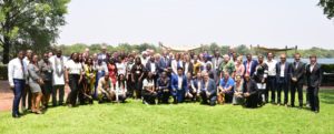
The training lasted for 25 days, comprised of in-door lectures, field excursions, demonstration, practice in instrumental methods, field mapping part, and final production of the map. The field part was conducted in small groups of trainees, each of them supervised by one expert from Czech Republic or Ethiopia. The training was coordinated by the Czech team and launched, thanks to the joint efforts of the experts from the Czech Geological Survey and the Geological Survey of Ethiopia, with support by local specialists from the Mekelle University and the Addis Ababa Science and Technology University. Twenty five trainees representing 13 different African countries (Benin, Cameroon, Comoros, Egypt, Ethiopia, Kenya, Botswana, Niger, Nigeria, Sierra Leone, Sudan, Tanzania, Zimbabwe) took part in the training, along with additional local participants from the Mining and Energy Agency of Tigray Region in Mekelle and Department of Geology, Axum University.
The crucial field parts were held in the Adwa area which has been selected as the field training site similiar to the first field session last year. It was complemented by several excursions focused on dominant tectonic and volcanological features of the Danakil Depression and the methodical excursions organized around Mekelle and the wider Adwa and Axum areas. The Adwa area represents ideally exposed and geologically varied terrain that includes metamorphosed basement rocks, Palaeozoic sequences, Mesozoic sanstones, Tertiary flood basalts and the youngest trachyte plugs of the dominant Adwa Hills, and serves as an ideal training location. The theoretical, introductory and data processing sessions took place in Mekelle and Axum.
The PanAfGeo WP1 mappig programme continues in Senegal to be closed in Namibia later this year.
Click here to read the full MediaRelease_PanafGeoWP1E5_Ethiopia2019F